Center for Disaster Risk Reduction and Community Development Studies
Vision
To be a Center of Excellence in Research in the field of Disaster Risk Reduction and Community Development Studies in Bhutan.
Mission
- To create adequate expertise in various disciplines of disaster risk reduction and community development studies for the benefit of society for enhanced awareness about the phenomenon and processes of natural and manmade disasters.
- Collaborate with the relevant government agencies and the other leading research institutes/organizations of other parts of the world in promoting disaster risk reduction using various scientific tools and thus to solve the problems of major loss during any disaster.
- Encourage individuals, groups of colleges and institutes under the Royal University of Bhutan to perform front-ranking research in science and technology.
- To promote scientific temper and awareness among the public and school children about disaster risk reduction leading to community development.
- Promotion of proven/viable technologies for harnessing of resources for the benefit of the local communities in the areas of construction of low-cost housing, use of locally available building materials for immediate housing construction after any disaster etc.
- To maximize the benefits that Bhutan could realize from her vast hilly regime for disaster risk reduction and community
development.
Center Activities and Highlights
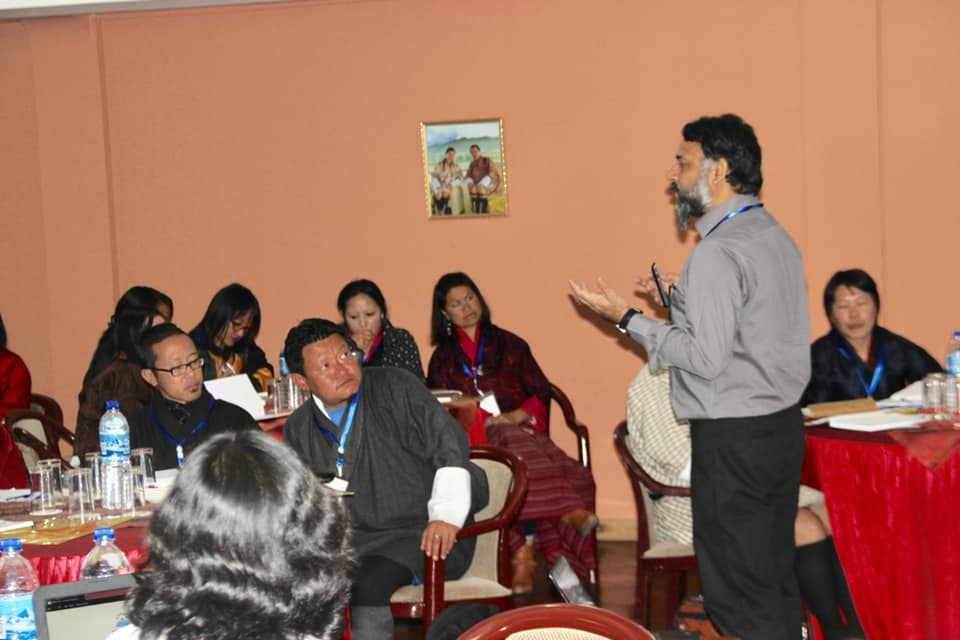
Faculty Development Program and Workshop on Climate Across the Curriculum
The Center for Disaster Risk Reduction and Community Development Studies, in partnership with IASPEI’s Commission on Education and Outreach and TROP ICSU, organized a Faculty Development Program and Workshop on Climate Across the Curriculum on 14–15 February 2019 in Thimphu. The program aimed to equip educators with effective climate education resources and strategies for integrating climate concepts into diverse subjects. Participants gained hands-on experience using TROP ICSU’s teaching tools, designed to enhance climate literacy across academic disciplines. The workshop strengthened the capacity of faculty members to deliver informed, interdisciplinary climate education within the Royal University of Bhutan. Its impact was reflected in improved curriculum integration, heightened awareness, and stronger commitment to climate-responsive teaching.
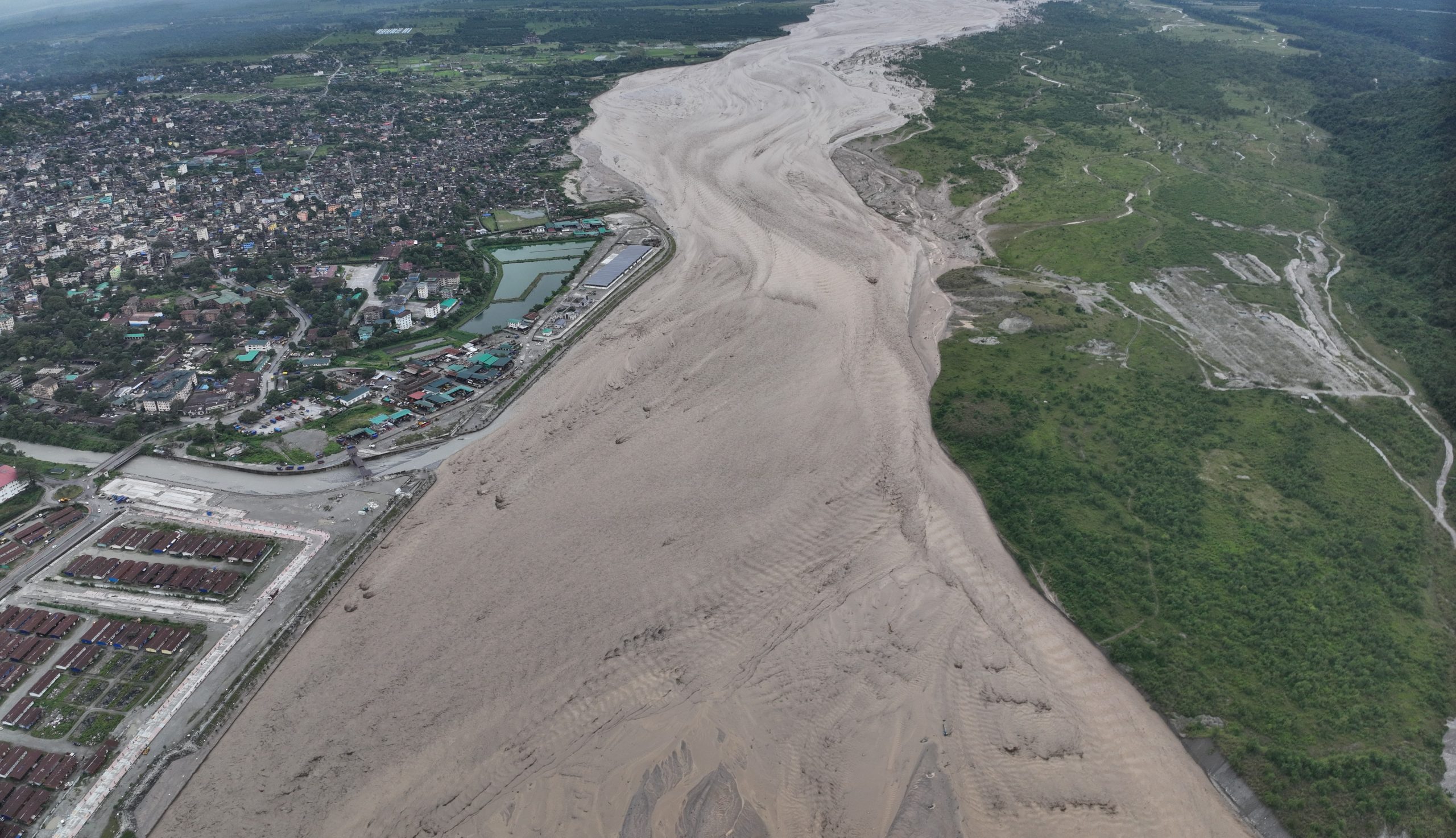
UAV monitoring during disaster
During the Toorsa flood of 5 October 2025, UAV-based monitoring played a critical role in enhancing the safety and effectiveness of the emergency response. Drones were deployed to locate stranded individuals, assess hazardous areas, and capture real-time visuals of rapidly changing ground conditions. This timely aerial information enabled responders to identify safe and accessible evacuation routes, reducing risks for both victims and rescue teams. The UAV operation was closely coordinated with disaster response units from the RBP, RBA, and Phuentsholing Thromde.
The high-resolution real-time imagery also helped responders prioritize areas requiring immediate intervention. Additionally, UAV support minimized the exposure of rescue personnel to dangerous zones by providing detailed situational insights from a safe distance. Overall, the integration of UAV technology significantly improved situational awareness and enhanced the overall effectiveness of the rescue and relief efforts.
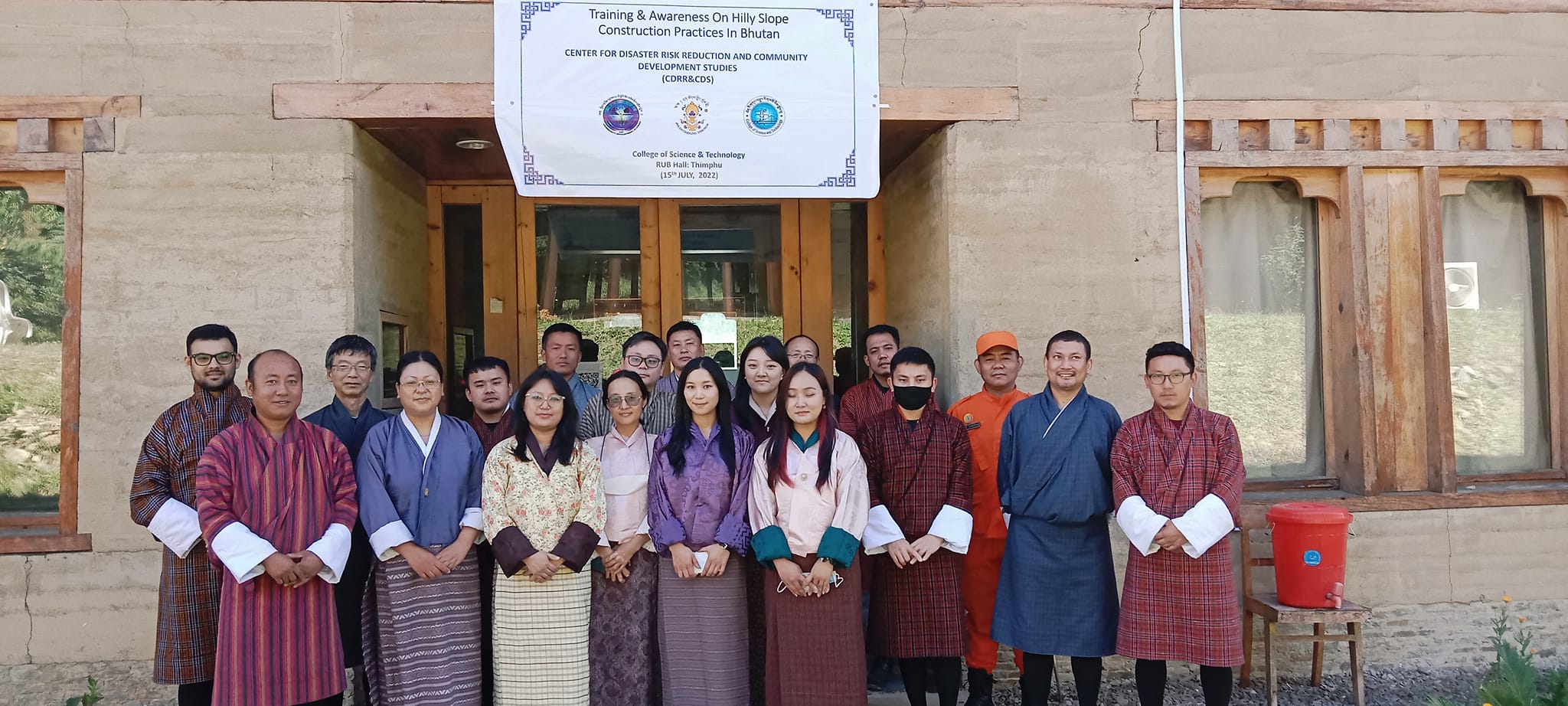
Awareness on Hilly Slope Construction Practices in Bhutan
The project on Hilly Slope Construction Practices in Bhutan, funded by CDRI, assessed current construction methods and risks in the country’s mountainous terrain. The study highlighted issues such as inadequate drainage, weak retaining structures, and limited geotechnical assessments, which increase vulnerability to landslides and infrastructure failure. Research findings, presented by the Center Head and team, emphasized the need for safer design practices and stricter engineering standards. Overall, the project aims to promote resilient and well-planned hillside construction across Bhutan.
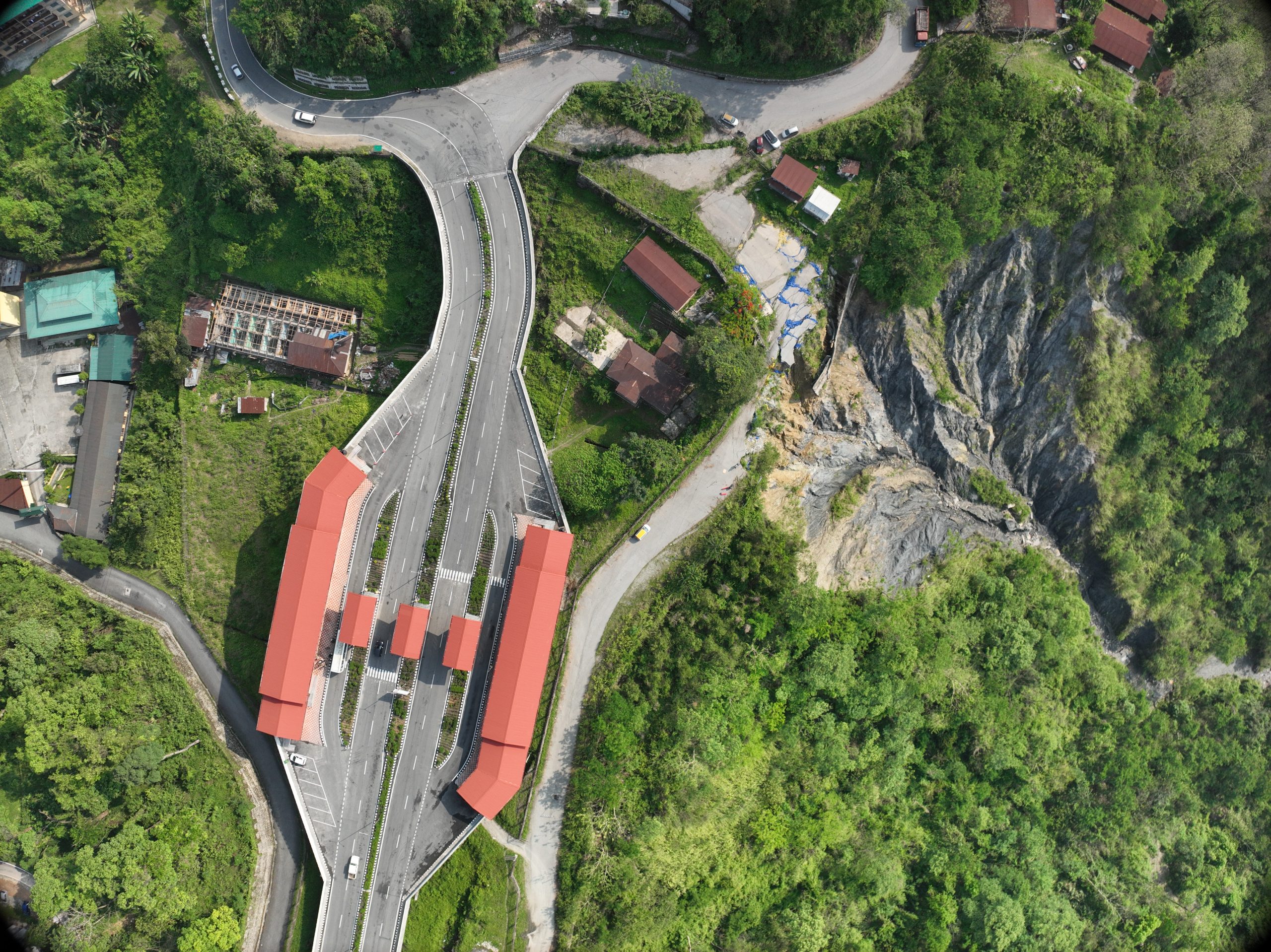
LiDAR survey for Landslide Assessment
A UAV-based LiDAR survey was carried out to assess an active landslide by producing a high-resolution Digital Elevation Model (DEM) and detailed topographic datasets, including contour lines and mapping of nearby built infrastructure. The centimeter-level accuracy of the LiDAR data provides essential insights into slope deformation patterns, erosion processes, and the evolution of gullies during the monsoon season. Such precision enables reliable volumetric analysis and change detection, which are critical for understanding landslide dynamics over time.
The dataset further supports geotechnical interpretation by identifying potential failure zones and drainage pathways. This advanced UAV-based methodology offers significant advantages over traditional ground surveys, particularly in steep, unstable, or inaccessible terrain where safety risks are high. It also allows for rapid data acquisition with minimal disruption to the site. The processed LiDAR outputs provide a robust foundation for engineering design and the development of targeted mitigation strategies. Overall, the survey enhances decision-making for hazard management by delivering accurate, spatially comprehensive, and actionable geospatial information.
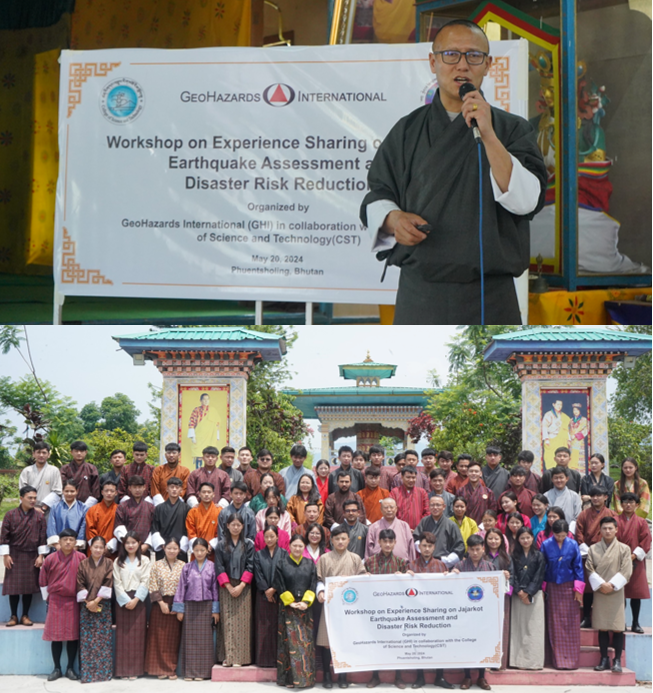
Seminar on Jajarkot Earthquake Assessment and Disaster Risk Reduction
The Center for Disaster Risk Reduction and Community Development Studies, in collaboration with Geohazard International (GHI), organized a seminar at the College of Science and Technology to promote awareness and knowledge sharing on the Jajarkot earthquake assessment and broader disaster risk reduction. The event featured expert presentations by Ms. Veronica, Dr. Hari Kumar, and Mr. Yeshi Lotay, and was attended by faculty members and students from the Civil Engineering and Engineering Geology departments.
Ms. Veronica, President and CEO of GHI, provided an overview of GHI’s initiatives in western Nepal following the Jajarkot earthquake, highlighting ongoing efforts to strengthen preparedness and resilience, including activities in Bhutan. Dr. Hari Kumar discussed fire safety and mitigation measures for residential, educational, and public buildings, emphasizing practical approaches to reducing fire-related risks. Mr. Yeshi Lotay shared observations from his recent assessment mission to Jajarkot, offering insights into the earthquake’s impacts and underscoring the need for robust disaster response systems and infrastructure resilience.
The session concluded with appreciation to the GHI team for their valuable contributions, which significantly enhanced participants’ understanding of geohazards and will support the development of more effective mitigation strategies in future projects.
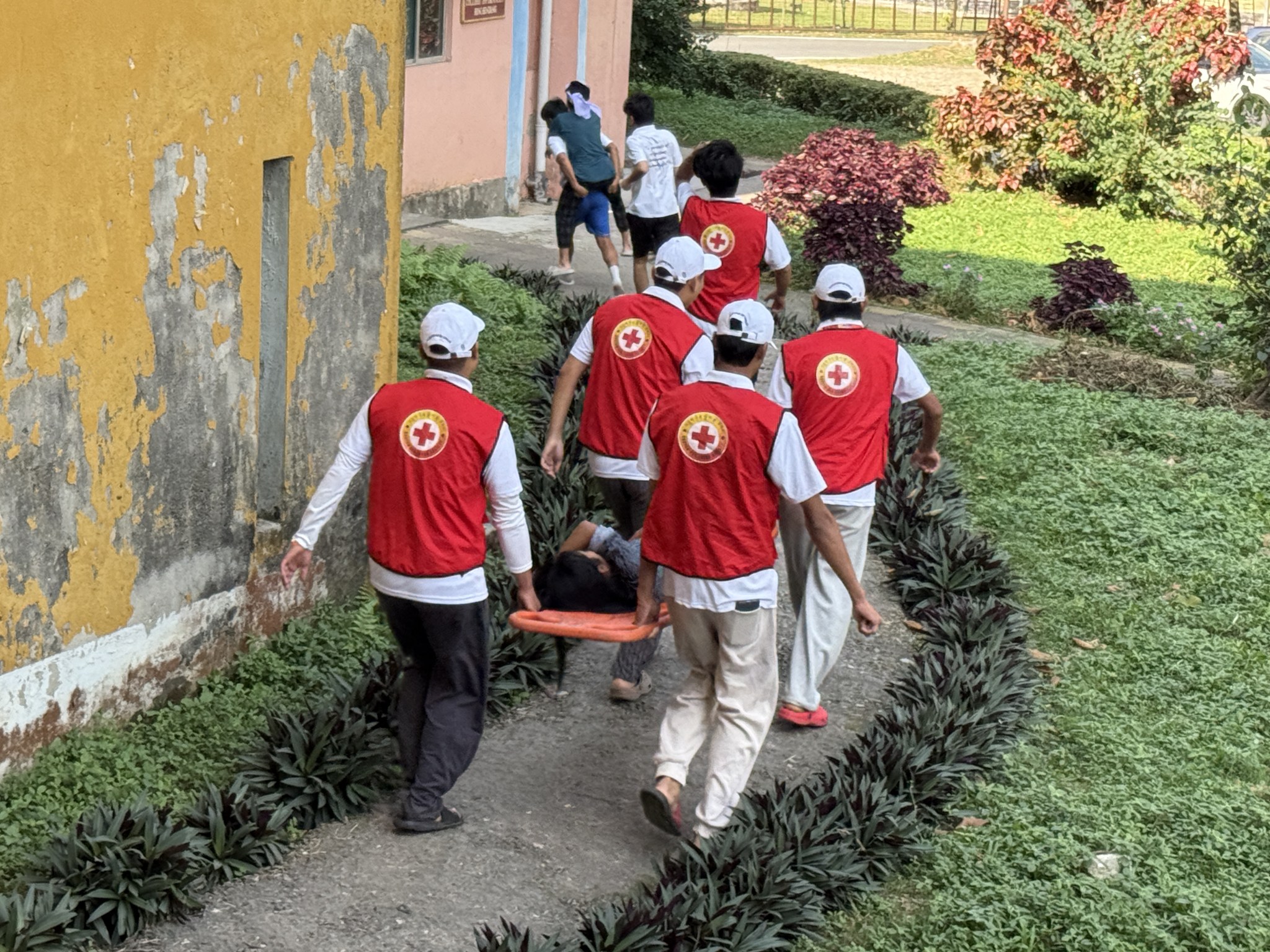
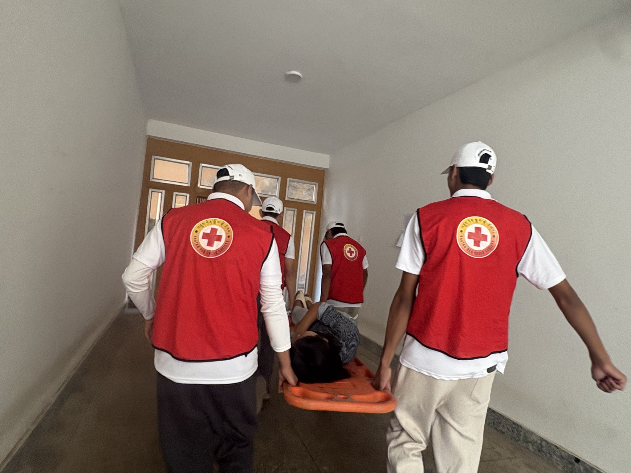
Mock Drill : Disaster Preparedness
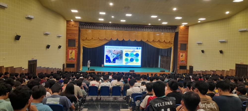
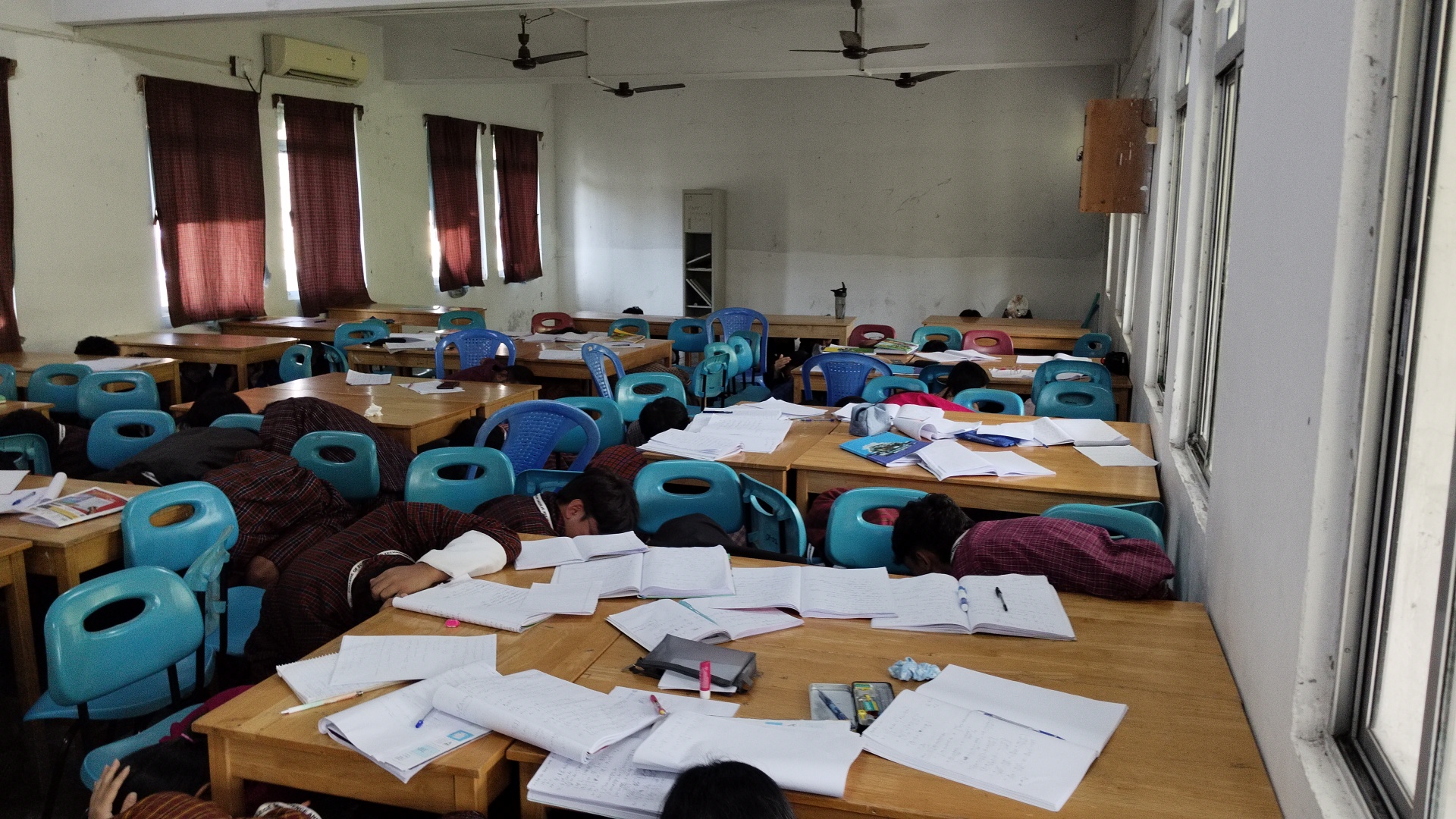
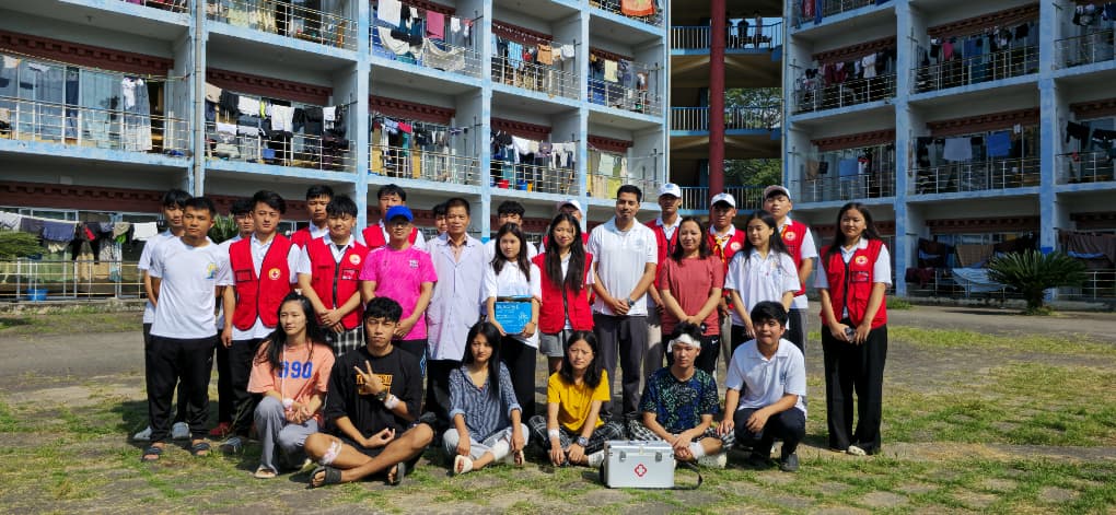
An earthquake disaster mock drill was successfully conducted at the College of Science and Technology on 25 October 2025. The exercise was coordinated by the Center for Disaster Risk Reduction and Community Development Studies (CDRRCDS), in partnership with the Dean of Student Affairs Office. A day prior, on 24 October, CDRRCDS Head Mr. Bhawani Shankar Nirola led an awareness session to prepare students for the drill.
During the briefing, students were informed about essential safety practices before, during, and after an earthquake, as well as the risks associated with seismic events. Impacts of major past earthquakes, including the 2015 Nepal and 2025 Myanmar events, were highlighted to reinforce understanding. The mock drill simulated real-time emergency conditions, enabling students to participate in evacuation and coordinated response activities. Rescue teams, health teams, and a media group took active roles in the exercise. Overall, the event aimed to enhance disaster preparedness, strengthen coordination, and build resilience within the CST community